Booking Detail
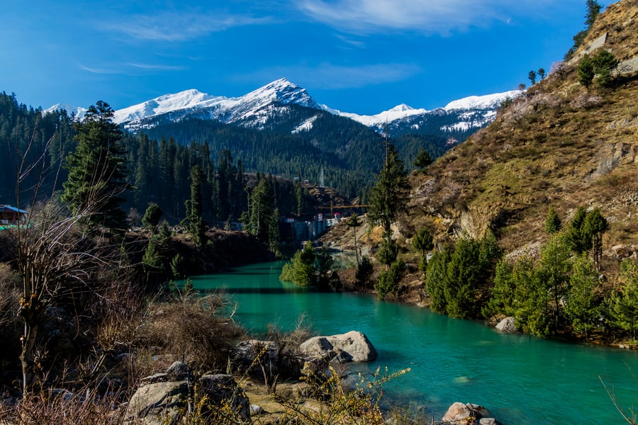
Sar Pass Trek
- 6 Days
- 5 Nights
- 20% Advance
- Best Price Guarantee!
- Lenient Cancellation Terms
Batch Availability
01-12-2021 to 06-12-2022 (Available)
02-12-2021 to 07-12-2022 (Available)
03-12-2021 to 08-12-2022 (Available)
04-12-2021 to 09-12-2022 (Available)
05-12-2021 to 10-12-2022 (Available)
06-12-2021 to 11-12-2022 (Available)
07-12-2021 to 12-12-2022 (Available)
08-12-2021 to 13-12-2022 (Available)
09-12-2021 to 14-12-2022 (Available)
10-12-2021 to 15-12-2022 (Available)
27-01-2021 to 01-02-2022 (Available)
28-01-2021 to 02-02-2022 (Available)
29-01-2021 to 03-02-2022 (Available)
30-01-2021 to 04-02-2022 (Available)
31-01-2021 to 05-02-2022 (Available)
Why Outside Explorer?
❤ GUIDES
Certified, Experienced, Soft Spoken and Well Mannered Local Trekking Guides
❤ EXPERTISE
We have been managing trekking events from last few years, which proves that we are experts of our field.
❤ 1000+ TOURS DONE
Till now we have done more than 1000 tours across India.
❤ POCKET FREINDLY PACKAGES
Our packages are very cost effective as compare to other travel agencies.
❤ VERIFIED REVIEWS
Our customers review us as one of the best trekking agency in Uttarakhand.
Sar Pass Trek
- Difficulty :
- Best time to visit : April to June and again from August to October.
- Temparature :
- Hightest Altitude :
- Pickup point : Dehradun
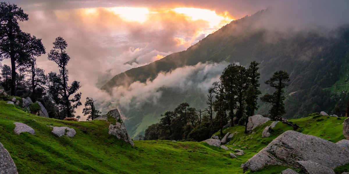
About Sar Pass Trek
Hampta Pass is a crossover trek where the scenery keeps changing as it starts from the lush greenery of Kullu region and ends in the arid desert of Spiti. This is an all in one trek where you go through alpine forests of (Maple, Brich, Oak, Deodar) and enter the wide meadows, trekking next to the streams and once you reach the start of the snowline it’s a steep ascend all the way to the pass. You are treated to a unique variety of exotic mountain wildflowers all through the trek.
These beautiful flowers embellish the landscape, the mighty rocks standing against the backdrop of delicate flowers make for a unique sight. You can expect three different scene changes in just the first two days from alpine forest to the green meadows and then to moraine. One can see a green valley on one side and a cold desert valley on the other side at a time.Initial side of the pass is gradual ascent which helps in a successful summit and the other side of a pass is steep descent which gives all the mountain rush you were waiting for. Indrasan, Deo Tibba and Indrakila are visible from the pass. Stream crossing through icy cold waters is one of the most thrilling experiences of Hampta Pass Trek but it can get tricky. You would find two water crossings during the trek.
The trek lies in the Pir Panjal range of Himachal Pradesh and is considered to be an easy to moderate grade trek. The trek goes up to an altitude of 14,100 ft at its highest point. The best time to visit is between June to September. The temperature usually stays between 10 to 18 degrees Celsius during the day and 0 to 5 degrees during the night. Since this trek has a couple of high altitude camp sites like Seagoru and Balu ka Ghera, the temperature here even drops to sub-zero at night.
Brief Itinerary
Day 1: Manali To Chika Via Jobra
- Altitude:- Jobra 9,800ft to Chika 10,100ft
- 2 hour drive to Jobra from Manali
- 2km, 45 minutes trek from Jobra to Chika
- Enough water through the trail
- Easy to Moderate trail
- Stay at tent
- Meeting time at Manali is 12 pm to reach Chika camp site by 5 pm
Day 2: Chika to Balu ka Ghera
- Altitude:- 10,100ft to 11,900ft
- 8.5Km, 6hr trek
- Moderate trail, gradual ascent
- Pack lunch will be provided
- Enough water on the way
- River crossing, boulder walk and colourful tiny flowers on the way
- Enjoy the camp site.
Day3: Balu ka Ghera to Siagoru, Crossing (Hampta Pass)
- Altitude:- 11,900ft to 14,100ft (Hampta Pass) to 12,900ft
- 7 km, 10hr trek
- No water point on the way (Depends on the snow condition)
- First 1 hour is gradual ascent then Steep ascent till the pass
- Packed lunch at the pass, enjoy the view of Indrasan peak
- Around 2 hours of steep descent and 1 hours of flat walk from the Pass to camp sight
- Coldest place of the trek
- Stay in tent
Day 4: Siagoru to Chatru drive to Chandratal
- Altitude:- 12,900ft to 11,000ft
- 7Km, 5hr trek
- Gradual descent on moraine
- Start early in the morning
- 2 to 3 water sources of water on the way
- Hot lunch at camp
- Drive to Chandratal and back to camp site, either on day 4 or day 5 (depends on road and weather condition)
Day 5: Chatru to Manali via Rothang Pass
- 85km drive
- Time taken 4-6 hour
- Breakfast at camp site
- Lunch on the way (not included in the cost)
- Rothang pass road is a very busy route; driving time may increase due to of heavy traffic. Make your further travel plane from
- Manali after 6:00 pm
NOTE:-
You can visit Chandratal If road and weather condition permits us. if not, you will have to drive directly from Chatru to Manali and skip Chandratal all together.
Who can go
- First timer can apply, should have some interest in trekking and mountaineering.
- The climber must be fit and have sufficient stamina to cover 5 km of distance in 30 minutes without a stress.
- The climber should be able to carry a 10-15 kg backpack.
- Heart problem, high blood pressure, asthma, and epilepsy cannot be reconciled on this mission. The climber must not have the conditions mentioned above.
Day 1: Manali to Chika via Jobra
The trekking expedition starts from Manali to Jobra in vehicle. Manali is already at an elevation of 6,700 ft above sea level. So, it is a good place to acclimatize your body before beginning the trek. It takes two hour and forty hairpin bends to arrive at Jobra. Jobra is at an altitude of 9,800 ft. On the first day you will reach a height of 10,100ft and cover up two to three hours of trek.
The trek on foot initiates from Allain Guhugal Hydel Project junction. After crossing the main road, take the small path that leads to the forest of pine trees. You will also find other variety of trees like maple, deodar, toss and oak. The sight is refreshing. The slope that is supposed to be climbed is an easy one and not very steep. Twenty minutes into the trek, you will reach a bend that overlooks a lush green meadow strewed with small rocks. Enjoy the surrounding for a couple of minutes and head towards the meadow.
The Rani nallah comes into view which flows directly in between the meadow. You will also see few sheep and cows grazing in the field. The sight looks exactly as if taken out from fairy tale. You can pass through the meadow or climb up the hill on the left hand side. Either way you will reach Chika which is at the end of the vast meadow. But, climbing the hill and descending down to Chika is a better and easier route. Chika camp site is a huge, spacious patch of green. The Rani River flowing in the middle makes this place perfect for setting up the tents.
Day 2: Janglik to Dayara Thatch
Wake up in the morning to a bright view of the valley. Breakfast and tea will be served before embarking ahead. Today's walk is one of the most scenic ones as you will walk past the beautifully crafted wheat fields that are set in front of wooden farmhouses. The artistic wooden houses with their attractive roofs look captivating and are sure to catch your attention. You will be able to spot the entire view of Diude, Tonglu and other small villages after climbing for an hour.
After that, we'll take some time for refreshments with a setting of pine trees surrounding us. The forest trail is not a treacherous one and will surely help you relax. You'll be amazed to see the trees surrounding you and the small streams which have a cooling effect on your senses. When such beauty surrounds you, it takes some time to soak in what mother nature has to offer so take your time and get a taste of your surroundings.
While deteriorating out of the tree line almost after an hour you will be greeted by the calming trees of Pine and Oak which are much more thicker and denser than the earlier ones. The dried leaves which are fallen on the floor make it look like a carpet of leaves which is put for you to walk on. The trail climbs gradually before coming out again. The Dayara meadows will be our spot for camping tonight. In the evening we'll climb the nearby hillock for better acclimatization. It is important for your body to be properly acclimatized to these conditions as you will be gaining more altitude. After coming back from the acclimatization walk, dinner will be served at your campsite.
Day 3: Dayara Thatch to Litham
You will start your day exploring the Dayara meadows after having your breakfast and hot tea that will be served at your campsite. You can take a walk just to soak in the freshness that the morning has to offer. The first rays of sunlight make the meadows look more artistic.
The trail which follows from Dayara to Litham takes you through dense forest, green meadows and gushing streams. Throughout the trail, there are streams where you can refill your water bottles. Before reaching the Dayara campsite you'll be able to see the snow-capped mountains of the Dhauladhars. You will come across the forest of Bhoj which has a beautiful setting. From here you'll be able to spot a clear view of Litham. After crossing the Chandranahan stream you will reach the Litham campsite. You will camp here for the night.
Day 4: Acclimatization day, visit to Chandranahan lake
We'll start early in the morning as today there is a steep ascent and descent. After having your breakfast we'll be visiting the Chandranahan lake for an acclimatization walk and will be coming back to Litham campsite. It is a very exciting and satisfying walk where you'll be getting a chance to click a lot of pictures along the way. We will continue walking upstream towards the waterfall from where it emerges.
You will also get good amount of snow in the month of June. As you reach the lake you will notice that the lake is a bit smaller in size and is fed by the snowfields around it. You can spend some time around the lake and click pictures of the panoramic view it has to offer before heading to Litham again. It will be a steep descent to Litham, therefore, you'll be starting early in the morning so that you reach Litham by lunch.
Day 5: Litham to Dhunda
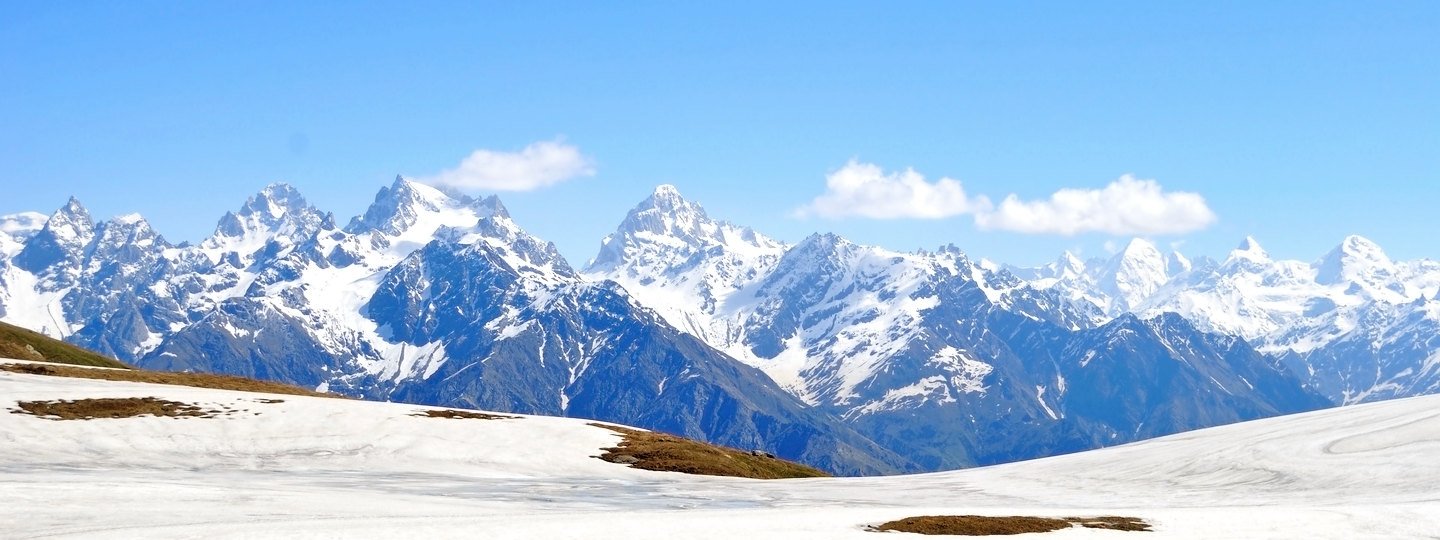
You will have to climb for 2 hours to Dhunda which is at an elevation of 13,300 ft. You will be able to see the Dhauladhar range which looms over the trail with Gunas pass sitting pretty on top of the snowy flanks of the grey mountains. It is a combination of grey and white mountains with the grassland of Litham in the left and Rupin Valley in the right. It has a sharp ascent which gives you the first view of Sar Pass to your left. Spend some time at this spot to click some wonderful pictures.
You will have to start the climb to Dhuna taking the shepherd trail that leads to the pass. From here you get a clear view of the Sar Pass trail to leads to it. You will be camping in the midst of snow-capped mountains which will encircle you from all four sides. When it comes to camping in the alpine mountains the entire campsite of Dhunda is one of the most picturesque ones.
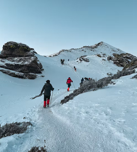
Day 6: Dhunda to Munirang (River camp) via Sar Pass Pass
Today we'll be trekking for almost 10-11 hours which will be both ascending and descending. In September, the snow melts and it is not difficult to climb the pass. Out of the Dhunda campsite follow the ridge and hop over boulders towards the base of the pass. From the base, it is an hour long climb to the top, mostly on snow. Sar Pass at exactly 15,000 ft is a thrilling climb. It is a narrow ledge on the top. The drop on the other side is sharp and steep. Without the rope, the descent can be risky even with an ice axe. Getting down to the first snowfield about 100 metres below the pass is your first objective. Thereafter it is a series of descents over smaller ledges that you can slide down!
After taking the ridge to follow the pass you will reach the base of the pass. It will take you an hour-long climb to the top of the pass which is situated at an elevation of 15,000 ft. You will have to be careful as it a narrow ledge on the top with a steep drop on the other side.
Day 7: Munirang (River camp) to Barua village, Drive to Shimla
On the last day of the trek, you will descend to the Barua village which is known for the vegetation. The trail is a beautiful one and a real treat for all the shutterbugs. You will be astonished to see the beauty this trek offers while descending. The trail goes quickly through the high altitude pines with a blend of other trees surrounding.
After descending for an hour and half the trail takes you to a large stream which meets the Barua Khud. As soon as you come out of the stream, you'll be able to spot a lot of shrubs which are lined on either side. You will also get a chance to spot trees of apricot and peaches along the way. After an hour, you'll be greeted by apple orchards and you'll spot signs of cultivation. When you reach the village the descent is more rapid. In half an hour you'll reach the road bridge. We will pick-up you by 1:00 pm for Shimla and you will reach there in between 10:00 to 11:00 pm, Please make your hotel booking at Shimla accordingly.
How to Reach Sar Pass Trek
By Air :
You can land at Jubbarhatti airport which is at a 22 km distance from Shimla. You may also have access to Chandigarh Airport or Delhi airport as per comfort. Thereafter, reach the departure point and then your journey will get started.
By Train :
The nearest station is Kalka from where you can reach the departure point via toy train or by booking cabs. It would be the best time to explore the beauty of Shimla.
By Bus:
You can always take roadways as a choice to reach Shimla. Shimla is connected to various cities via means of road. Luxury buses are also available from Delhi.
Sar Pass Trek Location
Includes
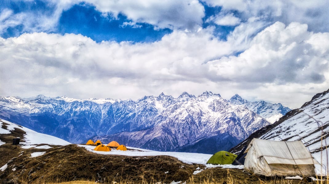
- Accommodation (Guest house, Home stay, Camping)
- Trek equipments: Sleeping bag, mattress, tent (twin sharing), kitchen & dinning tent, toilet tent, utensils and crampon (if required)
- Welcome refreshment
- Three times meals (Veg+egg): Breakfast, Lunch and Dinner
- All necessary permits and entry fees
- First aid medical kits, stretcher and oxygen cylinder.
- Mountaineering qualified & professional guide and Support staff.
- Transport from Dehradun to Sankri and retorn (According to itinerary)
- Porter or mule charges for carrying camping equipment and rations
- Morning Tea
- Evening Tea with snacks
- Guide Charges
- Hot drinking water
- Outside Explorers approved trek completion certificate
- Dry fruits, chocolates, biscuits, toffees provided during the trek
Excludes
- Porter/mule for personal bags
- Any meals or services not mentioned in inclusions
- Any charges for video cameras or still cameras
- Charges for soft drinks or any other beverage
- Personal expenses such as tips, laundry or telephone calls
- Any costs arising from unforeseen circumstances like landslides, bad weather or road blocks, etc
- Any kind of personal expenses.
- Food during the transit.
- Insurance.
- Mules or porter to carry personal luggage.
- Anything not specifically mentioned under the head.
- Any kind of emergency evacuation charges.
Note : Normally Outside Explorer expect to carry your personal luggage on your own, if you wish to offload your backpack, you can give it to Mule.
Charges of offloading backpack:-
- INR 1750/- if you make an online payment, 6 days in advance
- INR 1500/- if you inform us after reaching Sankri
- The backpack cannot weigh more than 11 kgs. Backpack should have waterproof cover. Suitcases/strolleys/ bags will not be allowed.
Thing's to carry
You need to get :-
- Shirts/T-shirts – 2/3
- Full sleeves T-shirts/ Sweatshirts. 1 for every 2 days of trekking
- Trekking pants – 2
- One full-sleeved sweater
- Good quality windproof jacket – (optional)
- Woolen socks – 1 pair, for the night only
- Regular socks for trekking – 2 or 3 pairs
- Scarf/muffler (optional)
- Raincoat / Poncho
- Small lightweight towel
- Water bottle-2
- Cap/hat to keep the strong sun away from your face
- Sun glasses
- Walking stick/trekking pole
- Sunscreen lotion
- Lip balm
- Torch/flashlight (with extra batteries)
- Day pack for essentials
- Rain cover for your bags
- Plastic/waterproof bags for belongs in case of rain
- Camera if you like (with fully charged batteries)
Frequently Asked Questions (FAQ's)
1Is proper supervision given while trekking/hiking?
Yes!!! We always give thorough guidance to the trekkers about each and every step they need to take in the whole trekking adventure. We never underestimate our customers in any terms.
2 How can we contact you?
Hey!!! We are always available to hear a word from you. You can contact us via any means and can get your query resolved on the spot. We never make any of our customers feel regret after choosing us.
Top Tips for Trekkers
Before you load up your backpack with trekking socks and Kendal mint cake, give some thought to the infrastructure on the route you plan to conquer. Some treks require total self-sufficiency, sleeping under canvas and purifying water as you go; other routes have refuges or rustic teahouses every step of the way. Here are some of the key considerations:
- Travel light: every extra gram will weigh you down on the trails; if it isn't essential, leave it behind.
- Respect your feet: boots offer more support, but all-terrain trainers are lighter and dry more quickly after a soaking.
- Protect your knees: trekking poles can help control the knee-crushing descents that are a feature of pretty much every trek.
- Climb slowly: Acute Mountain Sickness (AMS) can kill, so ascend slowly and take rest days to acclimatize on any trek above 2,500m in elevation.
- Heed the weather: when treks go wrong, it's normally because of the weather, so check the forecasts; if conditions look bad, stop somewhere safe and sit it out, rather than pushing on over the next pass.
- Be prepared: don't launch straight from the sofa to the summit–warm up with gentler walks, hikes and runs to get your body used to the exertion.
- Plan ahead: many trekking routes require a permit and advance booking for lodges and camp sites; for some routes, you need to book months ahead.